
New Release
We have released version 1.3 of the Edinburgh Geoparser and updated the accompanying lesson on the Programming Historian. The Geoparser now runs with a free OpenStreetmap visualisation by default. Anita Hawes, Publishing Assistant at Programming Historian, recently made us aware that users of the Geoparser who followed our lesson were asked to enter credit card details when creating the key for using Mapbox for the map visualisation. We want our language technology to be open and free, so we reacted quickly to fix that.
We have now changed the Geoparser’s visualisation component to use OpenStreetMap tiles by default. OpenStreetMap tiles can be used for light use free of charge (and without signing up to anything) in accordance with their Tile Usage Policy.
If you have a Mapbox account you can continue to use it with the Geoparser by setting the GEOPARSER_MAP_KEY environment variable as before, but make sure you are aware of the possibility that they may charge you if you have given them a credit card number and exceed their limits on free use.
This is the only change we made in v1.3 compared to v1.2. If you don’t use the visualisation component there is no need to update.
Watch out for Exonyms
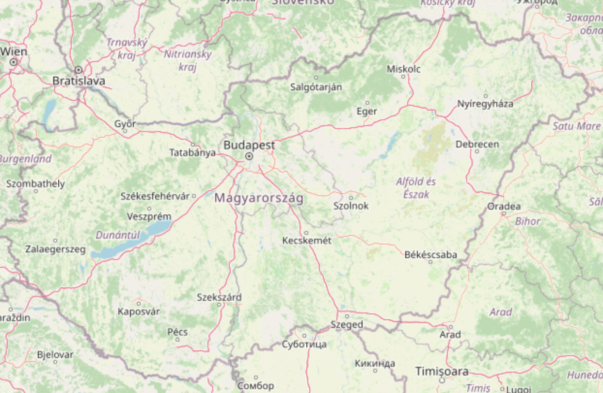
An exonym is a place name for which foreigners have a different name, like Munich for München. The main disadvantage of using OpenStreetMap tiles – from the point of view of an English-language geoparser – is that it generally displays maps in the language of the area or country, rather than English. This is a problem for exonyms as a place name on the map might not coincide with the name in the text. Despite this mismatch, it’s actually compelling to see how place names vary in different languages. For example, check out the place name for Hungary:
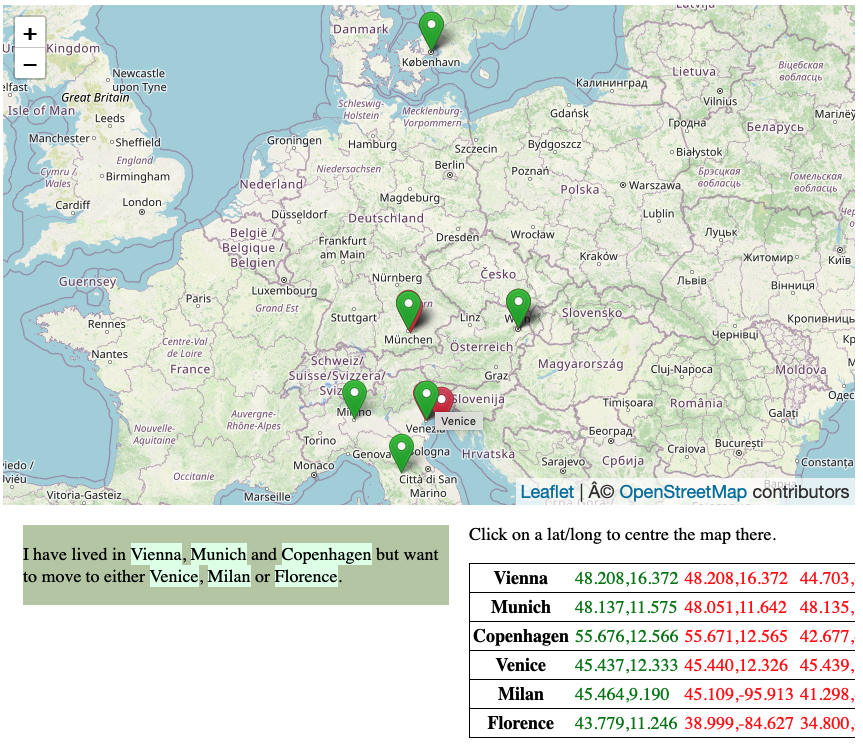
To help track your locations, the Geoparser visualisation centres the map on the corresponding pin when clicking on a place name that was recognised and is highlighted in the text and it also displays the recognised place name when hovering on the pin (see Figure 1).
Happy New Geoparsing!